On Friday night when Rich got home from work, we loaded up the car and took off. Being Labor Day weekend and after a record-breaking month of August with 31 days over 110+ degrees, everyone was heading out of town! The traffic was backed up from
Black Canyon City south, which cost us a whole extra hour of driving time.

We went through a few sprinkles when approaching
Flagstaff, but it was a beautiful night at our camping spot north of there. We didn’t get to sleep till 11:00 but were already up and breaking camp at 7:00 on Saturday morning. We continued north until we got to Hwy. 160 and headed diagonally across the Navajo Indian Reservation, past the
gateway to Monument Valley, and on to
Four Corners. This is
where the boundaries of New Mexico, Utah, Arizona, and Colorado meet, the only place in the U.S. where four states come together like that.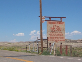
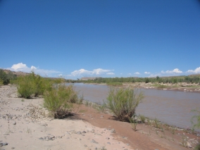
The San Juan River runs through there and that’s where we stopped to have our lunch. We didn’t realize at the time that the water in this river originates in the very San Juan Mountains of Colorado that we were heading for. Since the San Juan is on the western side of the Continental Divide, it flows southwest into New Mexico, past Farmington (where it meets up with its main tributary, the Animas River), northwest into Utah, and west to the Colorado River at Lake Powell near Rainbow Bridge.
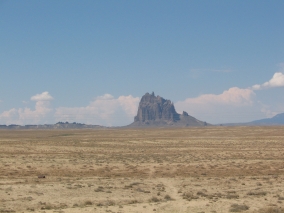
This whole section of the Colorado Plateau is a uniquely scenic area of canyons, red sandstone mesas, buttes, and angular volcanic rocks – including the landmark Ship Rock – rising dramatically 1700 feet above the desert plain.
We briefly drove through a tiny corner of New Mexico before entering Colorado on the Ute Mountain Indian Reservation. We saw the roads leading to Hovenweep National Monument, Canyons of the Ancients National Monument, and Mesa Verde National Park. These are all places that I would love to see, maybe someday. Now we know how to get to them, anyway.
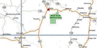
The first town that we came to in Colorado was Cortez. It looked like a nice little farming community. We drove east on Hwy. 160, this portion of which I later found out was The Old Spanish Trail, first used by Juan Maria de Rivera in 1765 and named by John C. Frémont in 1844. The Old Spanish Trail went from Santa Fe to Los Angeles, but strangely enough it bypassed Arizona – going through Colorado, Utah, and across the southern tip of Nevada instead.
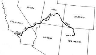
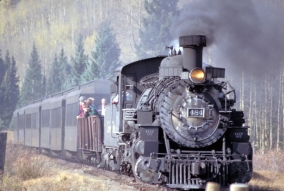
We headed into the mountain foothills and briefly ran through a rain storm. About an hour later we came to Durango, a college town and resort area that reminded me of Flagstaff, AZ. Durango is located in the pretty Animas River Valley. The Durango and Silverton Narrow Gauge Railroad runs along Animas Canyon between Durango and the mining town of Silverton, Colorado. We never saw the historic steam train, but here is a public domain photo of it:
Just like Flagstaff, the area around Durango is an outdoor lovers paradise – whether it’s visiting ghost towns, wilderness trekking, rock climbing, mountain biking, hiking, hunting, fishing, canoeing, rafting, kayaking, and off-roading. Jeeps are more common than ATVs here – they can be seen everywhere! Jeeping is popular on the primitive trails between all of the historic mining camps.

From Durango we drove north on Hwy. 550, a.k.a. The San Juan Skyway Scenic Byway. About 30 minutes north of downtown Durango is the Durango Mountain Resort at Purgatory, which is a small ski area. Despite all the snow, the San Juan Mountains are so steep that the only other ski resort in the area is Telluride, unless you count the cutting-edge Silverton Mountain extreme ski area. It is the highest ski area in North America with the longest drop, and it is also the steepest with no easy way down and requiring all skiers to carry their own avalanche rescue equipment.
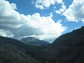
The road from
Durango to Silverton goes through alpine meadows, winds around mountainsides, and rises over high passes until it finally reaches the small frontier town of
Silverton, a former silver mining camp nestled in a mountain valley surrounded by beautiful peaks. The last large mine closed in 1991. Silverton is now a federally designated National Historic District and tourist destination. At 9,318 feet above sea level, Silverton is also one of the highest towns in the
U.S.
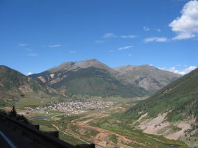
The Silverton Visitor Center is located in a nice old Victorian house painted light yellow. It’s situated in a community park with playground equipment, green grass, and even a paved running track. This was a great stop for the boys after being stuck in the car for hours! Following our time at the visitor center, we ate an early dinner in the historic Gold King Dining Room & Saloon adjacent to the Grand Imperial Hotel (established in 1882) on Silverton’s main street.
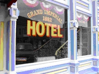
The Gold King Dining Room is a fun, family-friendly, smoke-free restaurant (no one was even sitting at the bar when we were there) and they have great food at reasonable prices, too. In addition to the menu items, they offer a weekend Mexican buffet and breakfast buffet, too. The décor includes a moose head, bison head, deer head, stuffed bobcat, and other assorted items of interest for kids to look at. Supposedly, Silverton's Sheriff Bat Masterson left a bullet hole in the ornately carved wooden bar while chasing an outlaw gang.
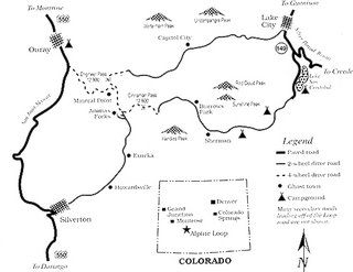
It was good to have a hot meal before heading out onto the Alpine Loop Scenic Byway. We would be driving about 18 miles northeast of Silverton to our camping spot in the American Basin. This portion of the Alpine Loop is a jeep trail suitable for four-wheel-drive vehicles only. (In this case, 4WD vehicles count as “jeeps” regardless of make. We have a Ford Expedition.) The Alpine Loop winds through the heart of the rugged but spectacular San Juan Mountains, between Silverton and Lake City. This road network linking together all of the mining camps was first used in the late 1800’s.
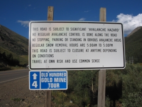
The first part of the Alpine Loop on the outskirts of town was lined with tents and trailers on both sides of the road. I never saw so many people camping in one area! It kind of reminded me of a gypsy caravan. Along the way we also passed by many old mines and dilapidated wooden structures – some of which were already collapsed and others which looked unstable to the point of being ready to fall down at any time.
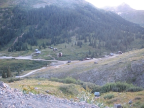
I always thought that Arizona had lots of ghost towns, but unfortunately nothing remains of most. I was surprised to see more real historic western structures still standing in the mountains of Colorado than there are in Arizona – including an entire abandoned townsite called Animas Forks! This is right near where the Animas River begins. Interestingly, its full name is El Río de las Animas Perdidas, or the River of Lost Souls. Read more about the living history of Animas Forks here: http://www.blm.gov/education/feature/1999/co/
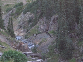
We even saw an old wooden footbridge over a ravine with the boards still dangling there, as if straight out of an Indiana Jones adventure. Sadly, we didn’t have time to stop and explore because sunset was approaching and we had to find our camping spot.
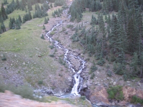
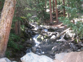
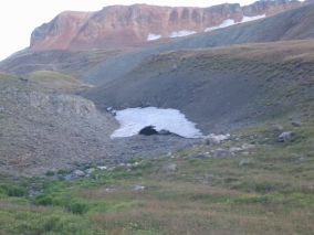
Another neat thing about Colorado was that there was water everywhere in the form of mountain streams, lakes, and waterfalls. As we rounded a bend near Cinnamon Pass, the next amazing sight we saw was snow! While in Arizona it was a hot 110 degrees, here in the high mountains of Colorado it was cold enough to have snow – even in August!
We’re used to driving on high-clearance jeep trails in our Ford Expedition. What we didn’t know was that the steep, narrow dirt roads of the Alpine Loop had suffered some serious damage as the result of heavy winter snows and summer rains. There are plenty of ruts and pretty good washouts in various places, with caution cones blocking off eroded sections along the edges of sharp dropoffs. This meant that its “hardness” rating as a 4WD road had increased significantly compared to previous descriptions we had read on the internet.
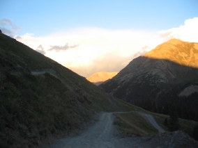 It was slow-going and scary sometimes because of the narrow steep road – there are plenty of places where you wouldn’t want to run into someone coming from the opposite direction! – but we did pretty well all the way past Cinnamon Pass at 12,640 feet. At that point, we had actually driven higher than the tallest mountain in Arizona. Then we came to a really sharp hairpin turn at a steep angle over protruding rocks with a rut in the middle. The rest of us got out of the car while Rich carefully nudged it over that spot.
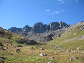
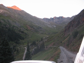 There were still people camping all along the way although the farther in we went, the less populated it was. The sun was going down when we finally found the American Basin turnoff. We set up our tent in a grassy meadow beside a gurgling mountain stream. I kept waking up at night and feeling a little queasy, but wasn't sure if it was due to the altitude (11,600 ft.) or the sound of the water making me seasick! I felt fine when I got up in the morning, though.

And no wonder there was snow up there, we were freezing that night! At least our sleeping bags kept us cozy. It was 41 degrees when we ventured out and checked the thermometer, so it may have been even colder during the wee hours of the morning.
Labels: Alpine Loop, Colorado, Handies Peak, mountain climb, San Juan Mountains
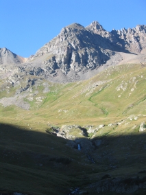 Since we were camping in the American Basin with tall peaks all around, the sun didn't reach us until 8:30 am. It was 41º
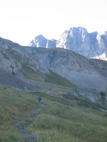
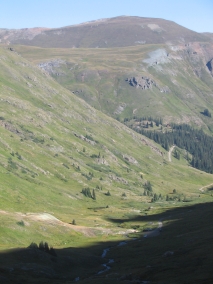 Even though we had to wait while Rich and Pete were gone for six hours, the time didn't seem that long. I got the car organized, looked at the map, and watched people come and go. A few climbers had gotten there even before us, but the majority of them came between 9:30-10:00 am. A few others didn't start out till the afternoon. Some people just drove up the